MicroStation GeoGraphics: a design tool for the connoisseur
June 2000

Bentley, a leader in design solutions, offers products and services that are based on a simple insight: engineering is a process, not an event. This concept is used to develop the most advanced engineering design software available on the market. Bentley believes that all engineering projects are in essence a cycle or continuum, with different people working on a variety of designs at different times. The software they use has to cater for all of these needs.
GIS combines spatial and nongraphical attributes with tools that allow users to explore the relationships inherent in spatial data. Although CAD and GIS regularly deal with the same types of information, these technologies are often thought of as being separate and distinct.
As a part of the overall strategy, Bentley's MicroStation GeoGraphics is a product in the Geo-engineering section, with a specific application. It is a fully integrated CAD/GIS solution with raster and vector functionality, created for engineers and application developers.
In extends MicroStation's Industry-standard data capture and editing tools with a solid database interface and powerful spatial analysis functionality. It integrates fully with MicroStation J and provides tools to input, manage, analyse and visualise geographical information within MicroStation.
MicroStation GeoGraphics allows users to integrate engineering and mapping applications under a single platform that emphasises workgroup computing, interoperability, and data consistency across multiple hardware platforms and operating systems. MicroStation GeoGraphics complements MicroStation with spatial analysis functionality, enhanced database capabilities, image management tools, and more.
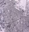
Feature-based mapping - beyond layers
At the core of MicroStation GeoGraphics is its feature-based design that allows users to interact with data in familiar terms. A feature is the combination of an element's logical name, graphical symbology, database attribution, and methods as defined by a user. These methods define the means by which features are created, modified, and manipulated, and can consist of any combination of MicroStation command key-ins, MicroStation BASIC scripts, MicroStation development language (MDL) programs, or user commands. Access to features is hand-led through the feature manager tools. This allows users to focus on the task at hand, rather than on the detailed mechanics of data entry and manipulation.
Using the MicroStation GeoGraphics feature group utility, users can define different hierarchical organisations for features, which provide easy navigation of large, complex features sets. In situations where different features coincide (for example, where a county boundary and corporate limit overlap), a single physical representation can be linked to multiple logical feature definitions, thus reducing data duplication.
Integrated map library management
The MicroStation GeoGraphics map management system insulates users from the physical organisation of map data by providing point-and-click access to map libraries. With the help of a generalised key map, an active spatial index, and a tile management system, users can rapidly find and retrieve individual maps. This means that users can navigate large, complicated map libraries without needing to know the details of underlying file organisations.
Building clean, accurate data
MicroStation GeoGraphics provides a suite of geometric clean-up and validation tools that enable users to quickly identify and fix geometric problems. Included are tools for finding and fixing duplicate and similar linework, endpoint gaps, intersections, dangling lines, and fragments based on user-defined tolerances. These interactive tools provide users with immediate feedback about errors and problems at the time of data entry, without loss of view context. All clean-up tools are tied into MicroStation's undo capability so that any clean-up operation can be 'rolled back' when tolerance settings produce undesirable results. Specialised geometric visualisation tools allow for fast identification of topological problems.
Improving database interaction
MicroStation GeoGraphics has a number of extensions that significantly improve MicroStation's ability to work with external databases. An interactive Query Builder helps the user create database queries and locate associated map features across a map library. MicroStation GeoGraphics SQL Manager allows users to locate, display, and edit database information associated with map features. MicroStation's database connectivity tools, including MicroStation ODBC capabilities, enable users to create and manage links between map features and non-graphical attributes that can be stored in a variety of databases, including Microsoft Access, Microsoft SQL Server, Oracle and Informix.
Spatial analysis and on-demand topology
As an option to storing topology, MicroStation GeoGraphics' spatial engine computes topological relationships on the fly, which means this data is never outdated. These on-demand topology tools allow users to create virtual topology layers containing point, line and polygon data. These topological layers are used to perform spatial operations, such as intersections, unions and adjacency, that can be filtered using standard SQL query criteria. MicroStation GeoGraphics' zone creation tools can help users to examine the proximal relationships between map features.
Unlocking the power of images
Through its image management capabilities, MicroStation GeoGraphics provides access to a wide range of image data including aerial photographs, satellite imagery and scanned maps and drawings. This high-performance image engine supports the display of bitonal, grayscale and continuous tone images that can supplement vector maps and provide a background for 'heads-up' feature digitising. The image exchange utilities allow users to import and export various image formats.
Map creation
Its precision graphics environment gives user control over many advanced features, including publication-quality fonts, user-defined linestyles, and custom symbol (cell) libraries. These features, combined with MicroStation's plotting capabilities (including plot resybolisation, feature prioritisation, plot previewing and combined raster/vector plotting), provide the user with all the tools necessary to create high quality maps.
Customisation - the key to high productivity
The customisation tools are accessible to users of all skill levels. The Session Save facility allows users to recall session information, including control of file attachments, view definitions, and display settings.
MicroStation BASIC, a full implementation of the language with extensions to all major MicroStation functions can be used to combine different MicroStation GeoGraphics' tools into workflow-specific applications. The macro record facility provides a simple, effective way to create BASIC scripts by simply recording the steps involved in a repetitive process. This feature allows users to write productivity programs without BASIC programming experience. The comprehensive development environment includes an editor, debugger, compiler and dialogue builder.
Other exciting new features
MicroStation also supports OLE automation and can expose its functionality to other OLE-driven applications through the use of a development environment such as Microsoft Visual Basic. Extensions to MicroStations/J's Java DGN package provide access to all MicroStation GeoGraphics project data.
The program comes with a full suite of MDI routines that give developers full access to the underlying graphics and spatial processing functions.
GeoGraphic features summary
* Seamlessly integrated CAD/GIS into GeoEngineering concept.
* Binary interoperability available on multiple platforms.
* Optimal applications development environment and tools.
* Integrated raster and vector GIS.
* Point-and-click interface.
* Operational feature-based versus layer-based file management.
* Advanced database management and interface.
* ODBC and OLE compliance.
* Capacity to manage large databases effectively.
Bentley SA
(011) 482 3262
Others who read this also read these articles
The high-end MCAD and cPDm market segments of the PLM strategy
CIMdata considers the high-end MCAD market to include only those few CAD solution providers that deliver very comprehensive computer-aided design and analysis capabilities that are also tightly integrated with an enterprise-capable cPDm solution from the same supplier[ December 2005 ]
SA's prototype designers awarded
The SABS Design Institute is the driving force behind design promotion in the country through various award schemes, supporting innovation and entrepreneurship[ October 2005 ]
2D to 3D: the path to better products, faster and cheaper
Modern 3D CAD systems allow designers and engineers to edit a few parameters and automatically create the downstream deliverables for unique variants in minutes, instead of days or weeks[ October 2005 ]
ECL in Africa
ECL ensures a worldwide coverage of its client base through local service units which incorporate all the ECL know-how[ August 2005 ]
Catia brings business to South Africa
The fact that the A400M contracts were awarded to local enterprises is a strategic breakthrough for the South African aerospace industry[ August 2005 ]
Strand7 analyses the Beijing Water Cube
The latest Strand7 Release 2.3 has added the capability to take site specific seismic time histories and simply create equivalent spectral curves[ June 2005 ]
Pro/E versus SolidWorks
In summary, SolidWorks' swept surfaces and solids are more limited in their capabilities than Pro/Engineer's[ June 2005 ]
Northern Railway Extension receives green light
Windhoek Consulting Engineers was appointed as consulting engineers for the Northern Railway Extension, responsible for all aspects regarding the design and construction supervision of the total project valued at N$ 1,4 billion[ April 2005 ]
Others who read this also read these news items
Digitising a standard racing engine provides a springboard for future improvements
[ December 2005 ]
Nelson Mandela Metropolitan University leads the way with Catia V5
[ December 2005 ]
Integrated CNC solution for SA tooling industry
[ December 2005 ]
Accelerated design at Donkin Fans
[ December 2005 ]
PGF transforms its vision into reality
[ December 2005 ]
Defy introduces new product range
[ October 2005 ]
New Smarts for legal eagles
[ October 2005, Cadshop ]
Vectorworks scores with architects on ease of use
[ October 2005 ]
Others who read this also read these regulars
Search Site
Subscribe
Previous Issues
Other Technews Publications
Other Technews Buyers Guides
 |  | Copyright c1995-2009 Technews Publishing (Pty) Ltd.. All rights reserved. |