Spatial document management
August 2004
Bentley offers a unique tool for the management of the drawings, models, images and other documents characterised as AEC (active energy control) content through geospatial extensions to its collaboration servers. Importantly, the tool is also available for ESRI data.
Tex van Deventer, managing director of Bentley Systems Africa, says "The most exciting product at the recent Bentley Empowered conference in the US must be the new spatial extension to our content and document management system, ProjectWise. ProjectWise is the most popular technical document and AEC content management tool in SA. Adding a spatial component opens up a whole new dimension. Just imagine looking at a map, picking a feature and asking for all drawing files or all reports or all deeds associated to that feature. Powerful! Off the cuff I can think of a host of excellent applications for this - mineral rights in the mines, accident reports in municipalities and traffic departments, anyone who has information that relates to an entity located on a map must have a use for this."
Why a managed environment?
A project like the New York subway illustrates the importance and enduring value of AEC content. Built a century ago, the project was approved in 1900 and the first lines opened in 1904. Construction required 7700 men to build a 21-mile route with four tracks. Today, the subway includes 230 miles of routes and over 400 miles of single track, and construction is not finished.
The New York Transit Authority has more than 500 000 drawings with 50 000 new drawings added each year. The new drawings are created differently than they were a century ago. Now MicroStation and other Bentley solutions are used, supplemented with information produced from other applications. Content includes vector files, models, scanned drawings, documents, contracts and spreadsheets, all with one thing in common - the information can be related spatially to a point or region of interest.
The use of PCs and file-based systems has weakened controls that have been around for over a century. The use of the sign and seal, and the disciplined exchange of paper documents was a highly controlled system. Bentley's managed environment seeks to reinstate such discipline into the digital management of AEC content through change management, intellectual property management, and information query and retrieval.
Change Management, or knowing who has access to what, and when, is critically important. Design History tracks who did what and when and provides a comprehensive audit trail of project history. Design History also supports the capability to return to a given stage of work, quickly reveal differences in drawings graphically and selectively undo design changes.
For Intellectual Property Management, Digital Rights manages who can do what to AEC content, and Digital Signatures verifies the author and seals changes. These capabilities bring the sign and seal discipline to the digital age and build on the change management capabilities.
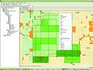
Information Query and Retrieval adds value by enabling effective use of AEC content. Since all content within the managed environment is indexed and attributed, content can be retrieved through navigation of file and component hierarchies, database queries, and hyperlinks. Perhaps a more intuitive method is spatial navigation. The spatially enabled managed environment delivers this key capability in a practical way that is easy to implement and that delivers immediate results.
Spatially enabled AEC content
At first glance, finding things spatially seems like GIS. By definition GIS is a self-contained, consistent and rigidly defined index of assets, related by location to a territory. The strength of GIS is in the analytical capabilities that such a paradigm enables. AEC content is rarely self contained. Work is conducted by collaborating players, typified by perpetual work in progress, and relies heavily upon drawings and models in document-based workflows. In a spatial context for AEC work is critical and distinct from GIS. While each leverages a spatial index, the information that is indexed - and the way that information is used - is very different. The two are complementary and a spatial index provides the appropriate medium to support the exchange of information, the foundation for AEC/GIS interoperability.
Spatial location
A 'spatial location' is geometry in any coordinate system such as latitude/longitude or some cartographic projection. When a spatial location is associated to a document, the document can be retrieved and displayed based upon spatial attributes.
It is critically important that the capture of spatial location be as unobtrusive as possible. We use a flexible process that minimises user intervention but maximises effective location capture. When documents are checked in, Bentley adopts the following location capture strategy:
* For documents with inherent coordinate systems-design files, GeoTiff images, shape files and so forth - the document location is automatically deduced.
* For documents that are a-spatial, such as Microsoft Office documents, a cascading strategy is used to capture location.
* The document can co-opt the location of the folder into which it is inserted.
* The document can inherit the location of any other folder or document.
* The user is presented with a map on which she/he can navigate and choose a location.
User applications may also be written to determine the location of a document based upon spatial information contained in, or associated to, the document. Many organisations use some standard (defined tags, file name standards, metadata) that can be programmatically leveraged for deducing spatial location intelligently.
Spatial navigation and query
Once spatial locations are registered, documents or sets of documents can be located through intuitive queries. Any mix of spatial and a-spatial attributes can constrain a query and be used in combination with spatial navigation. Typically, the user will use readily available spatially related attributes such as address, place name, postal code, area code or coordinates. To find documents with such attributes, an interface will be presented. Map navigation is also available for identifying the location of interest. Once the map is zoomed to the appropriate level of detail, a circular, rectangular or polygonal area can be specified and the query submitted. The result can then be displayed in a simple list of documents, or on a map.
Client support
To integrate navigational capabilities in a variety of client applications, an ActiveX Control, the Spatial Navigator, is provided. This control constitutes a ready-to-use component for Bentley products, as well as an open technology platform for custom clients. Spatial Navigator will be implemented in many Bentley clients. A simple HTML browser client will support Internet access, controls will be provided for hand-held devices and a Windows-based application will support intranet use. MicroStation V8 users can leverage the spatial interface to locate any design of interest.
Dynamic
The spatially enabled managed environment extends beyond location of documents and other information. At display time, maps and drawings of vector, raster or hybrid format can automatically be re-projected and accurately superimposed upon each other.
Bentley also provides ready-to-use and 'user definable' connectors to one or many 'geocoding servers' such as that offered by MapQuest. Once the geocoding server has resolved the address and provided a geographic coordinate, the spatial criteria can immediately be used in the query or used as input for displaying a map based on that coordinate.
AEC/GIS interoperability
Since Bentley will support direct interoperability with the ESRI geodatabase, users of a spatially enabled managed environment will also be able to access information managed by ESRI solutions and use it in the context of their AEC work. ESRI users will also benefit from updated infrastructure information that they can access through this same interoperable connection. These capabilities will allow analysts and planners that use ESRI products to work more closely with the engineer and architects that use Bentley solutions.
For more information contact Bentley Systems, 011 462 5811, www.bentley.com
Others who read this also read these articles
EDM - who needs it?
An EDMS is basically a computer database system designed for keeping track of documents, changes to them, related documents, and possibly to control the access to documents and assist or even enforce established procedures for workflow or QA[ December 2005 ]
What is up, docs?
DvTDM, the Total Document Manager developed by Practical Programs, and is available from Kinetic Distribution, can actually be configured to force documents to be stored within the system[ August 2004 ]
The CAD File is the business
CAD files form the technical foundation from which industrial businesses and plants are run[ August 2003 ]
The high cost of information erosion
Intergraph Process, Power & Offshore has developed integrated solutions and products to assure data accuracy and consistency, and enable the efficient creation, management and use of plant engineering information throughout the plant lifecycle[ June 2003 ]
Powerful document management solution
DataViewer X is an advanced Document and Drawing Management solution that can interface with leading CAD products to produce advanced technical and product document solutions[ February 2003 ]
Digital signatures resolve electronic catch-22
The much-touted 'paperless' work environment has finally become a reality[ December 2002 ]
MicroStation V8 is e-ready for digital signatures
Recent acknowledgment of digital IDs, certificates, and signatures offers new opportunities to streamline workflows and strengthen the protection of one's digital intellectual property[ October 2002 ]
Why scanning? - a South African perspective
A very large percentage of all the large format scanners sold into the South African market place have been grossly under-utilised and in some cases not used at all[ October 2002 ]
Others who read this also read these news items
A solution to CAD data management problems
[ October 2005 ]
Engineer your drawing management
[ August 2005 ]
The paperless age
[ June 2005 ]
Effectively handle document processes
[ April 2004 ]
Flexible solution for digitising drawings
[ February 2004 ]
Dataviewer X gets new name and enhancements
[ February 2004 ]
World's largest export coal terminal discovers SAP DMS
[ February 2004 ]
New software to index and archive scanned drawings
[ February 2004 ]
Others who read this also read these regulars
Search Site
Subscribe
Previous Issues
Other Technews Publications
Other Technews Buyers Guides
 |  | Copyright c1995-2009 Technews Publishing (Pty) Ltd.. All rights reserved. |