Partners for sustainable development
1 October 2002
At the recent World Summit on Sustainable Development (WSSD) that was held in Sandton, ESRI, with the assistance of GIMS, showcased GIS projects on sustainable development as well as GIS technology at the Ubuntu Village Exhibit, the plenary session at Sandton Convention Centre and at several side events.
During the last year, ESRI and GIMS have partnered with many institutions on two major initiatives related to GIS - My Community, Our Earth (MyCOE) and Geographic Information for Sustainable Development (GISD). The exhibit at WSSD for these projects focused on the importance of geographic information and related technologies to the successful implementation of sustainable development projects.
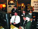
Some of the visitors that were present at the MyCOE exhibit
The vision of the organisers of My Community, Our Earth (MyCOE) is to build a geographically literate generation of people able to use this knowledge in their everyday lives to bring about true sustainable development. The MyCOE programme invites students worldwide to look geographically at issues of sustainability in their community, such as water quality, water pollution, population demographics and deforestation, and to suggest solutions for the future. Students use digital technologies, such as GIS software, or more traditional manual methods, such as hand-drawn maps and charts, images, and graphs, to convey their solutions for issues of sustainability in their own communities. The MyCOE exhibit showcased the best student projects of 2002.
On August 30th, the US Agency for International Development (USAID) sponsored a side event for MyCOE, where students, government officials, educators and GIS professionals discussed the importance of the projects and how these are essential to community level sustainable development. High school and university programmes are urged to become involved in the 2003 MyCOE project. Details may be found at www.geography.org/sustainable.
The GISD exhibit highlighted the use of geographic information for decision making related to such issues as natural resource management, public health, and poverty reduction by African institutions in a public-private partnership with the US government, universities, nongovernmental organisations, and private companies.
The GISD initiative is an international alliance to apply a new generation of earth observation data, geographic information technologies, and other elements of what specialists call 'spatial data infrastructure' (SDI) to help decision-makers address sustainable development problems in Africa. All GISD-sponsored projects involve testing new approaches to field-level management of such problems as food security, sustainable agriculture, natural resource management, disaster mitigation, and poverty alleviation.
GISD has focused on support to existing activities in Africa, many funded by USAID, to strengthen initiatives and programs that are directly involved in linking environmental and natural resources management to sustainable development. The lessons learned are shared online and through publications, and through exhibits such as the 2002 ESRI International User Conference and the World Summit on Sustainable Development.
For more information contact GIMS, 011 695 0400.
Others who read this also read these articles
Automotive and Aerospace Tooling Seminar
'Innovation' was the main topic of the seminar[ October 2005 ]
INSITE
South Africa's first, new International Science, Innovation & Technology Exhibition (INSITE) will showcase those ideas, innovations, products, technologies, services and solutions that are set to drive South Africa and the rest of the world forward into the future[ August 2004 ]
FM top 100 websites that save you time and money
Win HP products worth R20 000[ June 2004 ]
New search facility on cgweb.co.za
Technews has announced that the search engine on all its online magazines has undergone a radical upgrade.[ August 2003 ]
Championship winners use FEA for design optimisation
Algor's InCAD technology provides direct CAD/CAE data exchange and full associativity with each design change for Autodesk Inventor, which Morton uses when modelling load-bearing components[ June 2003 ]
Indigenous design key for manufacturing sector growth
Visionary development programmes, implemented by the South African Institution of Mechanical Engineering, are helping to foster interest in technology among school level learners[ April 2003 ]
Computers - how do they affect your eyesight?
There is now medical evidence that using display screen equipment is not associated with damage to eyes or eyesight, nor makes existing defects worse[ February 2002 ]
Shuttle mission begins its ambitous map of the world
Over ten days the SRTM payload mapped over 72% of the world's land areas, encompassing over 95% of the world's population[ Feb 2000 ]
Others who read this also read these news items
Breakfast with Clem Sunter and the JCCI
[ December 2005 ]
SABS disa product design award scheme calls for entries
[ December 2005 ]
Software for crash simulation
[ December 2005 ]
New appointment
[ December 2005 ]
Free downloads a success
[ December 2005 ]
Graficomp wins international award
[ December 2005 ]
Epson SA's channel partners recognised at annual awards
[ October 2005 ]
Free software download
[ October 2005 ]
Others who read this also read these regulars
Everest - getting better all the time
[ December 2005 ]
Roland inspiring creative people in every industry
[ August 2005 ]
The four pillars of Bentley
[ December 2003 ]
Bullish Bentley takes plant market by storm
[ February 2003 ]
Enterprise Engineering in transportation and civil engineering
[ October 2002 ]
Search Site
Subscribe
Previous Issues
Other Technews Publications
Other Technews Buyers Guides
 |  | Copyright c1995-2009 Technews Publishing (Pty) Ltd.. All rights reserved. |