Hikers, bikers and urban street pioneers
1 December 2005
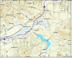
Die-hard off roaders and urban city slickers alike will enjoy the new release of SA Streetmaps Topographical and Recreation version from Garmap. For the uninitiated, Garmap's software is designed for managing track, route and way-point information on a Garmin-based GPS and also provides accurate map data on a CD-ROM, which can be used on a PC or loaded on the GPS itself.
The era of convergence between the serious 4 X 4 trailblazer and the off-road pavement pioneer is fast approaching with the introduction of recreational planning equipment such as the South African Topographical and Recreational software.
The South African Topographical and Recreational (SA Topo & Rec product, as it is referred to by those in the know) integrates with other detailed map bases such as SA Streetmaps and seamlessly overlays this information over a topographical tier providing a comprehensive SA map base for recreational planning and orientation in a specific area. MapIT provides the most extensive road coverage in South Africa and with technical partners, Georigin, have gained access to all Surveyor General's maps whilst developing this product. If you tried this, you would be carrying home over 2000 maps.
The visual and audio medium on your GPS unit allows this mapping tool to help plan your trip by using the SA Streetmaps software to get your specific location and the SA Topo & Rec info to guide you through a specific area of interest. Due to the size of the data on the SA Topo & Rec product, it is advised that this product be used in combination with the current SA Streetmaps V3 or Africa Road Atlas from MapIT.
SA Topo & Rec is non-auto routable but has got search capabilities on specific features.
This CD contains 1:50 000 topographic data for South Africa, Swaziland and Lesotho, with the GRID reference system based on the current 1:50 000 maps.
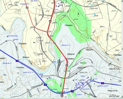
All roads as provided by SA's benchmark digital mapping company, MapIT, are provided and are combined with additional road data provided by the Department of Surveys and Mapping. Supplementary access thoroughfares such as farm roads, small town streets, hiking trails and gravel tracks have also been included. As SA Topo & Rec is not a routable product only road names and numbers of highways, main roads and through-routes have been included and made searchable. Similar to the 1:50 000 Streetmaps version, street names have been omitted.
SA Topo & Rec also provides topographical contours; trigonometry beacons; rivers; farm and farm portion boundaries; the boundaries and known names of every city, town and settlement in South Africa is included and searchable; parks and reserves; 4 x 4 trails; and complete railway info of South Africa is provided.
Areas of natural forests, woodlands and plantations within South Africa, Lesotho and Swaziland are shown and a myriad of Places of Interest (POIs) such as lodges, hotels, service stations and historical sites are included.
For more information contact Map Integration Technologies, 012 345 8015, www.mapit.co.za
Others who read this also read these articles
An intelligent, integrated approach
MapIT has crafted a Licensed Partner programme based on the common requirement for highly accurate mapping data[ October 2004 ]
Picture it ...
MarketScope can calculate virtually any demographic scenario for your marketplace, taking into account a variety of factors, including your customer profiles, census information, competitor analysis data and any other set of business-related statistics you wish to evaluate, and visually display the results, arriving at an answer within 30 seconds[ August 2004 ]
Mondi develops advanced GIS business system
Mondi Forests has a truly integrated GIS business system that not only takes care of daily operational requirements, but also facilitates the use of GIS decision-making technology[ June 2003 ]
Implementation of a GIS system in local government
The most cost effective and user friendly way of implementing the MIS system and making it accessible to all authorised officials and Councillors throughout the Municipality was to build a Web application using Bentley Publisher[ April 2003 ]
GIS technology saluted for social and economic contributions
GIS is a powerful analytical tool that integrates spatial (or location) data with associated information, presenting the result in an easy-to-understand, map-based format[ February 2003 ]
ArcGIS Schematics launched
ArcGIS Schematics offers a high degree of flexibility and is not limited by the evolution of the data model and by changing database locations[ February 2003 ]
Building a locations-based service
Before we can start any project, we need to know and understand what the system is going to be used for[ August 2002 ]
Sustainable fisheries and marine conservation in Kenya
A Microsoft Access database is being developed to manage the data[ August 2002 ]
Others who read this also read these news items
Image compression provides post-Katrina aerials within days
[ December 2005 ]
Navigation - the tip of the GIS iceberg
[ October 2005 ]
Fun and affordable in-car navigation
[ October 2005 ]
Cycling on the edge
[ October 2005 ]
Routing made easy
[ August 2005 ]
MapIT expands into West Africa
[ August 2005 ]
Incredible Connection powers navigation tools
[ August 2005 ]
Digital mapping enhances address data cleaning
[ April 2005 ]
Others who read this also read these regulars
ArcIMS 9.1 Route Server - routing and geocoding
[ October 2005 ]
Enterprise GIS with ArcGIS 9: a comprehensive GIS platform
[ October 2004 ]
GIS in Africa
[ August 2003 ]
Complete logistics and routing solution
[ August 2002 ]
ESRI offers highly integrated GIS solutions
[ April 2002 ]
GIS - the tool to help manage change in the 21st century
[ April/May 2000 ]
GIS software that sets a new standard
[ April/May 2000 ]
Search Site
Subscribe
Previous Issues
Other Technews Publications
Other Technews Buyers Guides
 |  | Copyright c1995-2009 Technews Publishing (Pty) Ltd.. All rights reserved. |