Desktop GIS for the future
December 2000
November 1999 saw the launch of the ArcGIS architecture. Offering object-orientation to spatial data, this new architecture promised to change the way GIS was being developed and implemented. Aiming to address the needs of professional GIS users, ArcInfo 8.0.1, the first of many products to make use of this new architecture, was simultaneously released.
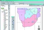
Following from this, GIMS has announced the release of ArcView 8.1, a product that promises to bring the desktop-user experience in line with that of the professional GIS user.
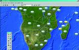
ArcView 8.1 is a new-generation GIS data visualisation, query and map creation solution, designed for the Windows desktop. ArcView 8.1 provides tools for integrating and visualising a wide range of popular GIS and mapping-related data formats (shape, DXF, DWG, DGN coverages, MIF, Geodatabases), geographic data exploration, spatial query and spatial data analysis as well as tools supporting basic geographic and metadata creation. The software also offers enhanced cartographic and data capture features. ArcView 8.1 includes a rich suite of editing tools to facilitate data automation and the update of shapefiles. It can also read coverages and uses the full functionality of the geodatabase to display data.
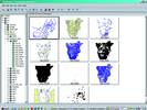
ArcView 8.1 consists of 3 new applications: ArcMap, ArcCatalog and ArcToolbox.
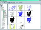
ArcCatalog
Gives the look and feel of Windows Explorer but from a spatial perspective. It allows the following functions:
* Browse and organise geographic data.
* Catalogue of data layers.
* Catalogue of maps.
* Catalogue of metadata.
* Browse and organise tabular data.
* Create and browse metadata.
* Search for data locally or on the net.
* Catalogue of data layers.
* Catalogue of maps.
* Catalogue of metadata.
* Browse and organise tabular data.
* Create and browse metadata.
* Search for data locally or on the net.

ArcMap
Gives users a Windows environment for editing and analysis of data as well as producing high quality cartographic maps.
* Enhanced editing tools.
* CAD-like geometry building.
* Annotation support.
* Exceptional map production.
* 12 000 symbol library.
* Dynamic graticules and neat lines.
* Advanced labelling.
* Layer level projection.
* Both map projection and datum support.
* Internet enabled.
* View maps from the Internet.
* Integrate Internet map data with local data.
* Direct connect to the geography network.
* Excellent charting and reporting.
* 2D and 3D business charts.
* Crystal reports.
ArcToolbox
ArcToolbox allows the user to import and project data with easy-to-use wizards and tools.
Geographic Information Management Systems
(011) 315 0390
The Agriculture Research Council Institute for Soil Climate and Water (ARC-ISCW) has been using ESRI's ArcInfo GIS products since the 1980's.
"The early Unix versions of the software were often perceived as having 'non-user friendly, difficult to use, and blank-black screen' technology - this despite the fact that they were based on a high-powered system architecture," commented Rudolph De Munnik, GIS Specialist and System Administrator. "Newcomers to ArcInfo had a steep learning curve and needed to become expert typists due to the command line interface.
"The first user break-though came with the release of ArcInfo 7 for Windows NT workstation. This version made it possible to move away from the Unix back-end, but was still bound to the Unix-type user interface.
"The development of ArcInfo 8 for NT Desktop resulted in ArcInfo becoming even easier to use with most processes being wizard-based. The NT Workstation version is still mainly command line driven for the Unix -gurus," De Munnik adds.
"We are also looking forward to the new functionality which includes the combination of ARCIMS datasets as an extra data source from anywhere in the world through ArcView and ArcInfo modules," he concludes.
Rudolph De Munnik
GIS Specialist and System Administrator
ARC-ISCW
Others who read this also read these articles
An intelligent, integrated approach
MapIT has crafted a Licensed Partner programme based on the common requirement for highly accurate mapping data[ October 2004 ]
Picture it ...
MarketScope can calculate virtually any demographic scenario for your marketplace, taking into account a variety of factors, including your customer profiles, census information, competitor analysis data and any other set of business-related statistics you wish to evaluate, and visually display the results, arriving at an answer within 30 seconds[ August 2004 ]
Mondi develops advanced GIS business system
Mondi Forests has a truly integrated GIS business system that not only takes care of daily operational requirements, but also facilitates the use of GIS decision-making technology[ June 2003 ]
Implementation of a GIS system in local government
The most cost effective and user friendly way of implementing the MIS system and making it accessible to all authorised officials and Councillors throughout the Municipality was to build a Web application using Bentley Publisher[ April 2003 ]
GIS technology saluted for social and economic contributions
GIS is a powerful analytical tool that integrates spatial (or location) data with associated information, presenting the result in an easy-to-understand, map-based format[ February 2003 ]
ArcGIS Schematics launched
ArcGIS Schematics offers a high degree of flexibility and is not limited by the evolution of the data model and by changing database locations[ February 2003 ]
Building a locations-based service
Before we can start any project, we need to know and understand what the system is going to be used for[ August 2002 ]
Sustainable fisheries and marine conservation in Kenya
A Microsoft Access database is being developed to manage the data[ August 2002 ]
Others who read this also read these news items
Hikers, bikers and urban street pioneers
[ December 2005 ]
Image compression provides post-Katrina aerials within days
[ December 2005 ]
Navigation - the tip of the GIS iceberg
[ October 2005 ]
Fun and affordable in-car navigation
[ October 2005 ]
Cycling on the edge
[ October 2005 ]
Routing made easy
[ August 2005 ]
MapIT expands into West Africa
[ August 2005 ]
Incredible Connection powers navigation tools
[ August 2005 ]
Others who read this also read these regulars
ArcIMS 9.1 Route Server - routing and geocoding
[ October 2005 ]
Enterprise GIS with ArcGIS 9: a comprehensive GIS platform
[ October 2004 ]
GIS in Africa
[ August 2003 ]
Complete logistics and routing solution
[ August 2002 ]
ESRI offers highly integrated GIS solutions
[ April 2002 ]
GIS - the tool to help manage change in the 21st century
[ April/May 2000 ]
GIS software that sets a new standard
[ April/May 2000 ]
Search Site
Subscribe
Previous Issues
Other Technews Publications
Other Technews Buyers Guides
 |  | Copyright c1995-2009 Technews Publishing (Pty) Ltd.. All rights reserved. |