A solution that uses GIS to enable the effective management of resources
June 2000
The market for managing and maintaining infrastructure is vast, as everything around us forms part of some sort of infrastructure. Due to the conditions of operation and the environmental influences these infrastructures need to be maintained and properly managed.
The development of mobile technology, such as palm tops, increased productivity, increased processing power of PCs, rationalisation of staff, etc are all factors that are pressuring management to effectively maintain and manage infrastructure.
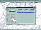
AfriGIS has addressed this need by embarking on the development of a comprehensive software system directed at the market of infrastructure maintenance. Managing Infrastructure Applications, (MIA) as it is called, is a software system and database model used in the field of Infrastructure Maintenance Management. The system is applicable to most types of Infrastructure and will assist maintenance professionals to optimise the use of infrastructure. AfriGIS already implemented the application in the road pavement environment as a pavement management system, which allows maintenance managers to optimise the maintenance of their road networks.
The MIA system is based on a GIS platform, which forms the backbone of the system, from data collection to reporting and optimisation.
Why GIS?
GIS technology combines alphanumeric databases with electronic maps to enable the display of various data types on a map. Most GIS software, however, does not have an integrated relational database model, which is required for a comprehensive infrastructure management system. MIA focuses on this aspect and provides the extension to GIS to allows it to be used as an Infrastructure Maintenance tool.
A spatial object such as a street link is location specific; meaning it can only be at a specific location at a specific time. These location characteristics of spatial objects thus allow location analysis. This means that where a specific street link needs to be maintained, the system can also report what related infrastructure is involved. This would include relevant information, such as which other street links are close by, which other services, such as storm water or traffic conditions, might be influenced when maintenance is done, as well as the condition of the nearby street links. The topology included in GIS systems caters for flow analysis such as what areas will be influenced when a water network valve is closed, or traffic implications during rehabilitation of a pavement section.
Because most infrastructure information is based on the spatial information such as location and address, GIS technology is playing an increasing role in the development of new infrastructure management applications for local and national infrastructure authorities.
One of AfriGIS's MIA projects involved the updating and upgrading of the current Pavement Management System (PMS) for the Greater Germiston Council (GGC).
The system makes provision for the capturing of data using GIS. This information is then used in analysis models, which predicts future conditions. GIS-based reports, graphs and maps are then generated, which depict general infrastructure information, current and future conditions as well as optimised maintenance – and budget strategies.
The PMS for the GGC clearly shows how introducing GIS with an infrastructure management application could be used to assist maintenance managers and professionals in optimising the maintenance and management of infrastructure.
AfriGIS
(012) 362 3114
Others who read this also read these articles
An intelligent, integrated approach
MapIT has crafted a Licensed Partner programme based on the common requirement for highly accurate mapping data[ October 2004 ]
Picture it ...
MarketScope can calculate virtually any demographic scenario for your marketplace, taking into account a variety of factors, including your customer profiles, census information, competitor analysis data and any other set of business-related statistics you wish to evaluate, and visually display the results, arriving at an answer within 30 seconds[ August 2004 ]
Mondi develops advanced GIS business system
Mondi Forests has a truly integrated GIS business system that not only takes care of daily operational requirements, but also facilitates the use of GIS decision-making technology[ June 2003 ]
Implementation of a GIS system in local government
The most cost effective and user friendly way of implementing the MIS system and making it accessible to all authorised officials and Councillors throughout the Municipality was to build a Web application using Bentley Publisher[ April 2003 ]
GIS technology saluted for social and economic contributions
GIS is a powerful analytical tool that integrates spatial (or location) data with associated information, presenting the result in an easy-to-understand, map-based format[ February 2003 ]
ArcGIS Schematics launched
ArcGIS Schematics offers a high degree of flexibility and is not limited by the evolution of the data model and by changing database locations[ February 2003 ]
Building a locations-based service
Before we can start any project, we need to know and understand what the system is going to be used for[ August 2002 ]
Sustainable fisheries and marine conservation in Kenya
A Microsoft Access database is being developed to manage the data[ August 2002 ]
Others who read this also read these news items
Hikers, bikers and urban street pioneers
[ December 2005 ]
Image compression provides post-Katrina aerials within days
[ December 2005 ]
Navigation - the tip of the GIS iceberg
[ October 2005 ]
Fun and affordable in-car navigation
[ October 2005 ]
Cycling on the edge
[ October 2005 ]
Routing made easy
[ August 2005 ]
MapIT expands into West Africa
[ August 2005 ]
Incredible Connection powers navigation tools
[ August 2005 ]
Others who read this also read these regulars
ArcIMS 9.1 Route Server - routing and geocoding
[ October 2005 ]
Enterprise GIS with ArcGIS 9: a comprehensive GIS platform
[ October 2004 ]
GIS in Africa
[ August 2003 ]
Complete logistics and routing solution
[ August 2002 ]
ESRI offers highly integrated GIS solutions
[ April 2002 ]
GIS - the tool to help manage change in the 21st century
[ April/May 2000 ]
GIS software that sets a new standard
[ April/May 2000 ]
Search Site
Subscribe
Previous Issues
Other Technews Publications
Other Technews Buyers Guides
 |  | Copyright c1995-2009 Technews Publishing (Pty) Ltd.. All rights reserved. |