Guidance from above
1 June 2004
Nomadic tribes and mariners of old used the stars, but if you have no idea which way is up on the Southern Cross or think a supernova is the newest boy band, then navigational help is at hand just for you!
Digital map developers, MapIT brings navigation into the hands of Joe Citizen. In a world where we are constantly looking for 'the next big thing' in technology and have high expectations after Bluetooth and Wi-Fi, we are all surely eager to give the current 'next big thing' a try - GPS. Global positioning systems is becoming a significant feature in the era of communication in the global village.
Although GPS-based navigation has been commonplace in aircraft, boats and luxury cars for a while now, for anyone else wanting to get to a new destination, only the reliable (but challenging) paper-based map book was available. Now, in developments using the best of GPS technology and South Africa's most accurate digital maps, a number of portable and wireless devices such as PDAs and mobile phones are bringing navigation into the real world. Although still considered high-end devices, Pocket PCs are becoming more commonplace with the advent of digital cartography.
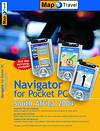
Industry luminaries, users and developers of a product called map and travel navigator are upbeat at the emergence of this technology which will dramatically change the world of direction-related capability and mapping. All that is required is a GPS-enabled PDA and the CD-based map and travel navigator mapset. This navigation tool uses MapIT's South African mapsets and routing software from European leaders in mapping, map and guide GmbH, to produce map and travel navigator.
Bundled packages containing Pocket PC, built-in or separate GPS unit, cabling and mapping software already loaded, are available from brand names such as HP and Mio. However, if you already have a Pocket PC and GPS functionality, you need only get the map and travel navigator software which loads onto your desktop and then, via ActiveSync, onto the handheld device. Coupled to your Pocket PC, map and travel navigator will give you full navigation capability including voice alerts as you drive, visual assistance in two map view options, your exact position and a number of other custom settings to get you to your destination.
MapIT MD, Ray Wilkinson is enthusiastic about the direction that location sensitive technology is taking. "We have demonstrated that innovations using georeferencing of all kinds of data herald a revolution in the application of digital maps and geographic information systems," he says. "Map and travel navigator is the first in a number of navigational tools that will assist travellers with in-car or on-foot navigation, previously only available to top-end users. In conjunction with partners such as HP, we are able to offer a much broader market the pleasure of fully functional navigation and route planning."
How does it work?
Mounted in a car in a removable device, or handheld if you are on foot, the GPS receiver has to acquire the necessary number of satellites to get a positional fix. US Defense satellites provide this and in order to work, one needs to be situated in a fairly obstruction-free environment and have been spotted by at least three satellites. This means that GPS does not work indoors, in tunnels, or between tall buildings. There are 25 satellites orbiting the earth, 12 of which are above the horizon at all times. By measuring the time it takes for signals to pass from four of these satellites to your GPS receiver, the software component of a GPS system can work out the distances between you and the satellites and then calculate your exact position.
Once you have been picked up the GPS, coupled with the mapping software, shows you where you want to go after you have selected the travel options you require eg, fast car, slow car or on-foot and the route directions such as most direct, fastest or most economical route. Keep track of your speed this way, too - the GPS sometimes differing from your speedometer which can be disconcerting. The one to be believed is the speed judged by the satellite.
Search to find points of interest (POIs) such as shopping centres, petrol stations and hospitals. Coverage reaches the entire country and map and travel navigator will estimate your time of arrival at your destination based on the route taken. At this point, traffic patterns are not integrated into this calculation, but this advance is under development, so local knowledge will have to guide you for the moment.
Once the route is calculated, voice prompts alert you to the distance to your next turn and give you the direction. If you misunderstand or miss a turning, the unit will recalculate the new route and prompt you again.
Extra functionality provides the exact distance to be travelled and an 'ahead-of-time' indication of upcoming turnings. Along with audible instructions you also have visual screen displays, should your passenger wish to view the route being taken or should you wish to cast a quick eye on the easy on-screen interface.
For more information contact Map Integration Technologies, 012 345 8020.
Others who read this also read these articles
An intelligent, integrated approach
MapIT has crafted a Licensed Partner programme based on the common requirement for highly accurate mapping data[ October 2004 ]
Picture it ...
MarketScope can calculate virtually any demographic scenario for your marketplace, taking into account a variety of factors, including your customer profiles, census information, competitor analysis data and any other set of business-related statistics you wish to evaluate, and visually display the results, arriving at an answer within 30 seconds[ August 2004 ]
Mondi develops advanced GIS business system
Mondi Forests has a truly integrated GIS business system that not only takes care of daily operational requirements, but also facilitates the use of GIS decision-making technology[ June 2003 ]
Implementation of a GIS system in local government
The most cost effective and user friendly way of implementing the MIS system and making it accessible to all authorised officials and Councillors throughout the Municipality was to build a Web application using Bentley Publisher[ April 2003 ]
GIS technology saluted for social and economic contributions
GIS is a powerful analytical tool that integrates spatial (or location) data with associated information, presenting the result in an easy-to-understand, map-based format[ February 2003 ]
ArcGIS Schematics launched
ArcGIS Schematics offers a high degree of flexibility and is not limited by the evolution of the data model and by changing database locations[ February 2003 ]
Building a locations-based service
Before we can start any project, we need to know and understand what the system is going to be used for[ August 2002 ]
Sustainable fisheries and marine conservation in Kenya
A Microsoft Access database is being developed to manage the data[ August 2002 ]
Others who read this also read these news items
Hikers, bikers and urban street pioneers
[ December 2005 ]
Image compression provides post-Katrina aerials within days
[ December 2005 ]
Navigation - the tip of the GIS iceberg
[ October 2005 ]
Fun and affordable in-car navigation
[ October 2005 ]
Cycling on the edge
[ October 2005 ]
Routing made easy
[ August 2005 ]
MapIT expands into West Africa
[ August 2005 ]
Incredible Connection powers navigation tools
[ August 2005 ]
Others who read this also read these regulars
ArcIMS 9.1 Route Server - routing and geocoding
[ October 2005 ]
Enterprise GIS with ArcGIS 9: a comprehensive GIS platform
[ October 2004 ]
GIS in Africa
[ August 2003 ]
Complete logistics and routing solution
[ August 2002 ]
ESRI offers highly integrated GIS solutions
[ April 2002 ]
GIS - the tool to help manage change in the 21st century
[ April/May 2000 ]
GIS software that sets a new standard
[ April/May 2000 ]
Search Site
Subscribe
Previous Issues
Other Technews Publications
Other Technews Buyers Guides
 |  | Copyright c1995-2009 Technews Publishing (Pty) Ltd.. All rights reserved. |