Tracking ore efficiency
1 December 2004
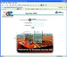
Skorpion Zinc Mine deployed Bentley MicroStation and GeoGraphics software for its Planning and GIS operations. The workflow of the survey department requires much more intensive calculation and preparation to determine the ore volume that has been moved from the open cast pit and whether the process is effective.
Bentley Geospatial partners, GRID, started to audit the as-is process, helping the mine in getting all their features into the GIS system. Throughout the exercise it was necessary to first get a good understanding of the existing workflow before any recommendations or improvements to the process could have been made.
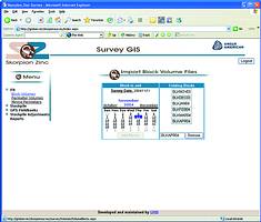
The process starts with a regular survey of the open cast pit by means of a sub-meter accurate GPS. All the information from the GPS gets downloaded into the Survey GIS system, which in turn loads all the information into an SQL database.
Information is labelled to indicate its origin and destination, pit walls and depths are indicated by means of layers, and all the pit blocks are labelled from the surveyors' master pit plan.
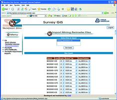
With the information loaded into the database and after certain calculations by survey-specific software has been taken into account, the Survey GIS system can extract the month-end reports for head office. The reports will indicate blasting volumes, how much material has been moved and finally how much useful ore has been sent to the refinery. This also helps management to track waste and unaccounted ore.
For more information contact Bentley Systems SA, 011 462 5811, www.bentley.com
Others who read this also read these articles
An intelligent, integrated approach
MapIT has crafted a Licensed Partner programme based on the common requirement for highly accurate mapping data[ October 2004 ]
Picture it ...
MarketScope can calculate virtually any demographic scenario for your marketplace, taking into account a variety of factors, including your customer profiles, census information, competitor analysis data and any other set of business-related statistics you wish to evaluate, and visually display the results, arriving at an answer within 30 seconds[ August 2004 ]
Mondi develops advanced GIS business system
Mondi Forests has a truly integrated GIS business system that not only takes care of daily operational requirements, but also facilitates the use of GIS decision-making technology[ June 2003 ]
Implementation of a GIS system in local government
The most cost effective and user friendly way of implementing the MIS system and making it accessible to all authorised officials and Councillors throughout the Municipality was to build a Web application using Bentley Publisher[ April 2003 ]
GIS technology saluted for social and economic contributions
GIS is a powerful analytical tool that integrates spatial (or location) data with associated information, presenting the result in an easy-to-understand, map-based format[ February 2003 ]
ArcGIS Schematics launched
ArcGIS Schematics offers a high degree of flexibility and is not limited by the evolution of the data model and by changing database locations[ February 2003 ]
Building a locations-based service
Before we can start any project, we need to know and understand what the system is going to be used for[ August 2002 ]
Sustainable fisheries and marine conservation in Kenya
A Microsoft Access database is being developed to manage the data[ August 2002 ]
Others who read this also read these news items
Hikers, bikers and urban street pioneers
[ December 2005 ]
Image compression provides post-Katrina aerials within days
[ December 2005 ]
Navigation - the tip of the GIS iceberg
[ October 2005 ]
Fun and affordable in-car navigation
[ October 2005 ]
Cycling on the edge
[ October 2005 ]
Routing made easy
[ August 2005 ]
MapIT expands into West Africa
[ August 2005 ]
Incredible Connection powers navigation tools
[ August 2005 ]
Others who read this also read these regulars
ArcIMS 9.1 Route Server - routing and geocoding
[ October 2005 ]
Enterprise GIS with ArcGIS 9: a comprehensive GIS platform
[ October 2004 ]
GIS in Africa
[ August 2003 ]
Complete logistics and routing solution
[ August 2002 ]
ESRI offers highly integrated GIS solutions
[ April 2002 ]
GIS - the tool to help manage change in the 21st century
[ April/May 2000 ]
GIS software that sets a new standard
[ April/May 2000 ]
Search Site
Subscribe
Previous Issues
Other Technews Publications
Other Technews Buyers Guides
 |  | Copyright c1995-2009 Technews Publishing (Pty) Ltd.. All rights reserved. |