Greater Johannesburg road centreline project
1 December 2000
Kantey & Templer Consulting Engineers has made extensive use of AllyCAD to complete the capture of the road centrelines for the entire Greater Johannesburg area. In an area of some 1200 sq km, extending from Diepsloot in the north, Orange Farm in the south and in the west from Protea Glen to Herriotdale in the east, K&T; used digital aerial photography as a spatial backdrop to draw lines and to capture information. In total, some 9000 km of road centrelines and GIS attribute data were captured. This project is still ongoing in that unpaved roads in newly established townships are being captured to complete the entire road network. The capture of all roadside stormwater network data is now being added to the centreline data.
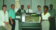
KT CAD and GIS staff standing in front of the new HP 1050C plotter, supplied by Allyson Lawless and used to plot high quality colour plots
Project Director for K&T, Barry Alport, says: "Using AllyCAD we were able to index and view a mosaic of 12 GB of digital images quickly and easily with software and hardware at a fraction of the cost compared to competitive software products."
Clients for this project are the four local Johannesburg Metropolitan Councils, viz Northern, Southern, Eastern and Western, as well as the Johannesburg Roads and Stormwater Agency.
Allyson Lawless
(011) 476 4100
Others who read this also read these articles
An intelligent, integrated approach
MapIT has crafted a Licensed Partner programme based on the common requirement for highly accurate mapping data[ October 2004 ]
Picture it ...
MarketScope can calculate virtually any demographic scenario for your marketplace, taking into account a variety of factors, including your customer profiles, census information, competitor analysis data and any other set of business-related statistics you wish to evaluate, and visually display the results, arriving at an answer within 30 seconds[ August 2004 ]
Mondi develops advanced GIS business system
Mondi Forests has a truly integrated GIS business system that not only takes care of daily operational requirements, but also facilitates the use of GIS decision-making technology[ June 2003 ]
Implementation of a GIS system in local government
The most cost effective and user friendly way of implementing the MIS system and making it accessible to all authorised officials and Councillors throughout the Municipality was to build a Web application using Bentley Publisher[ April 2003 ]
GIS technology saluted for social and economic contributions
GIS is a powerful analytical tool that integrates spatial (or location) data with associated information, presenting the result in an easy-to-understand, map-based format[ February 2003 ]
ArcGIS Schematics launched
ArcGIS Schematics offers a high degree of flexibility and is not limited by the evolution of the data model and by changing database locations[ February 2003 ]
Building a locations-based service
Before we can start any project, we need to know and understand what the system is going to be used for[ August 2002 ]
Sustainable fisheries and marine conservation in Kenya
A Microsoft Access database is being developed to manage the data[ August 2002 ]
Others who read this also read these news items
Hikers, bikers and urban street pioneers
[ December 2005 ]
Image compression provides post-Katrina aerials within days
[ December 2005 ]
Navigation - the tip of the GIS iceberg
[ October 2005 ]
Fun and affordable in-car navigation
[ October 2005 ]
Cycling on the edge
[ October 2005 ]
Routing made easy
[ August 2005 ]
MapIT expands into West Africa
[ August 2005 ]
Incredible Connection powers navigation tools
[ August 2005 ]
Others who read this also read these regulars
ArcIMS 9.1 Route Server - routing and geocoding
[ October 2005 ]
Enterprise GIS with ArcGIS 9: a comprehensive GIS platform
[ October 2004 ]
GIS in Africa
[ August 2003 ]
Complete logistics and routing solution
[ August 2002 ]
ESRI offers highly integrated GIS solutions
[ April 2002 ]
GIS - the tool to help manage change in the 21st century
[ April/May 2000 ]
GIS software that sets a new standard
[ April/May 2000 ]
Search Site
Subscribe
Previous Issues
Other Technews Publications
Other Technews Buyers Guides
 |  | Copyright c1995-2009 Technews Publishing (Pty) Ltd.. All rights reserved. |