Endangered Wildlife Trust celebrates GIS launch
1 August 2001
The GIS Project of the Endangered Wildlife Trust (EWT) was recently launched at the Johannesburg Country Club. GIMS will be assisting with the development of this project, having already donated an ArcView and Spatial Analyst to the EWT. At present the EWT has failed to take advantage of this innovative technology, but has now acknowledged the benefits of utilising spatial data in the most efficient manner through GIS technology. The EWT plans to centralise data at their head offices, allowing standardisation of data and the prevention of the duplication of work. This will lead to increased efficiency and productivity by the working groups whose time and funding resources are often limited. In this way many more conservation objectives can be achieved.
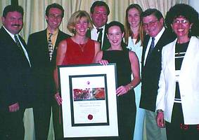
Pictured at the launch are from left: Rudolf De Munnik (GIMS), Charles Oosthuizen (GIMS), Ingrid Landman (GIMS), Dr Ian White (KNP) Lauren Solomon (GIMS), Brenda Daly (EWT), John Ledger (Chairman EWT) and Coral Wilder (EWT)
Conservation management is currently at a turning point, where we have moved from ad hoc conservation initiatives to well integrated and planned strategies. Many working groups within the EWT emphasise the anthropogenic sources of direct mortality (poisoning, shooting, and collision) in the species being conserved. Even though these issues need to be addressed, focus needs to be placed on the less tangible sources (land transformation and mismanagement and habitat loss). Geographical Information System is a means of measuring these effects and to assess landscape quality from an endangered species perspective.
In order for conservationists to be taken more seriously it is necessary for their initiatives and arguments to be based on transparent principles and scientific data. It is then much easier to participate in strategic, political and economic debate than if priorities are based on whims and personal preferences. Identifying priority species and areas for conservation can be useful for fundraising by emphasising specific interests of potential donors. The common thread of the Raptor Conservation Group (RCG) and Vulture Study Group (VSG) is the gathering of information from a large geographical area throughout southern Africa.
Successful examples of the use of GIS in conservation are the mapping of annual movement patterns by the South African Crane Working Group of Blue Cranes using satellite telemetry. Tools such as GIS make it easier to collect, collate and report this information. The White Stork project run by the Avian Demography Unit using the ARGOS satellite ground-station in Toulouse, France makes extensive use of modern tools and GIS and provide the necessary infrastructure for the high visibility penguin tracking, after the Treasure oil spill off Cape Town (Penguin Percy).
Modern tools need to be used in the proactive management of data, the monitoring of trends and an interactive management support system for field officers. This will allow EWT to have valuable resource in lobbying of parliament with regard to endangered species, as well as increase efficiency in the response to threats of endangered species, while providing valuable input into environmental impact assessments.
"It is hoped that with the help of Geographic Information Management Systems (GIMS) this can happen. We look forward to cultivating a long-lasting relationship with our new partners, GIMS," concludes Brenda Daly of the EWT.
Endangered Wildlife Trust
(011) 646 4629/8617
Geographic Information Management Systems (GIMS)
(011) 315 0390
Others who read this also read these articles
An intelligent, integrated approach
MapIT has crafted a Licensed Partner programme based on the common requirement for highly accurate mapping data[ October 2004 ]
Picture it ...
MarketScope can calculate virtually any demographic scenario for your marketplace, taking into account a variety of factors, including your customer profiles, census information, competitor analysis data and any other set of business-related statistics you wish to evaluate, and visually display the results, arriving at an answer within 30 seconds[ August 2004 ]
Mondi develops advanced GIS business system
Mondi Forests has a truly integrated GIS business system that not only takes care of daily operational requirements, but also facilitates the use of GIS decision-making technology[ June 2003 ]
Implementation of a GIS system in local government
The most cost effective and user friendly way of implementing the MIS system and making it accessible to all authorised officials and Councillors throughout the Municipality was to build a Web application using Bentley Publisher[ April 2003 ]
GIS technology saluted for social and economic contributions
GIS is a powerful analytical tool that integrates spatial (or location) data with associated information, presenting the result in an easy-to-understand, map-based format[ February 2003 ]
ArcGIS Schematics launched
ArcGIS Schematics offers a high degree of flexibility and is not limited by the evolution of the data model and by changing database locations[ February 2003 ]
Building a locations-based service
Before we can start any project, we need to know and understand what the system is going to be used for[ August 2002 ]
Sustainable fisheries and marine conservation in Kenya
A Microsoft Access database is being developed to manage the data[ August 2002 ]
Others who read this also read these news items
Hikers, bikers and urban street pioneers
[ December 2005 ]
Image compression provides post-Katrina aerials within days
[ December 2005 ]
Navigation - the tip of the GIS iceberg
[ October 2005 ]
Fun and affordable in-car navigation
[ October 2005 ]
Cycling on the edge
[ October 2005 ]
Routing made easy
[ August 2005 ]
MapIT expands into West Africa
[ August 2005 ]
Incredible Connection powers navigation tools
[ August 2005 ]
Others who read this also read these regulars
ArcIMS 9.1 Route Server - routing and geocoding
[ October 2005 ]
Enterprise GIS with ArcGIS 9: a comprehensive GIS platform
[ October 2004 ]
GIS in Africa
[ August 2003 ]
Complete logistics and routing solution
[ August 2002 ]
ESRI offers highly integrated GIS solutions
[ April 2002 ]
GIS - the tool to help manage change in the 21st century
[ April/May 2000 ]
GIS software that sets a new standard
[ April/May 2000 ]
Search Site
Subscribe
Previous Issues
Other Technews Publications
Other Technews Buyers Guides
 |  | Copyright c1995-2009 Technews Publishing (Pty) Ltd.. All rights reserved. |