Bentley introduce GIS and database integration
1 December 2001
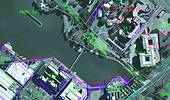
iSpatial transforms Bentley's MicroStation into a comprehensive GIS environment with data collection, editing and analysis tools. Through its integration with Oracle's database technology, iSpatial allows users to integrate engineering and mapping applications on a single software platform and extends the industry standard data capture and editing tools in MicroStation with a solid database interface and spatial analysis functionality.
At the core of iSpatial is its feature-based design, allowing users to interact with data in familiar terms. A feature is the combination of an element's user-defined logical name, graphical symbology, database attribution and methods. Access to features is handled through the iSpatial's Feature Manager tools, which provide a concise and intuitive interface for multiple users to interact with features. This allows users to focus on the task at hand, rather than on the detailed mechanics of data entry and manipulation.
iSpatial's interaction with Oracle means that multiple users are able to access relevant data, via conventional methods or using the Internet. In addition, users only have to access the Oracle database - they are not required to access iSpatial itself. This allows companies to cut costs substantially, as they will not have to purchase user licenses for every project team member who needs to access data.
iSpatial allows users to view a full graphical picture of the data set. At the same time, however, users can access information through conventional query methods when necessary, without having to negotiate a troublesome graphical interface. In this way, iSpatial caters both to users who require graphic interpretations of information, and those who need to process large sets of raw data.
When accessing information with iSpatial, data retrieval is conducted according to the specific query. This means that users can create seamless data sets in a single layer, without any file size limitations. When data retrievals are conducted, iSpatial only accesses the relevant information, allowing for a fast and streamlined data retrieval process. Oracle technology also allows users to back up their entire data set on a separate server, ensuring that their data is kept secure and will not fall prey to infrastructure failures or downtime. Equally, the Oracle database environment ensures the highest levels of security. Users are required to have the correct access privileges in order to access information.
Migration tool
Another feature of iSpatial is the ability given to users modifying data to lock the data under modification. This means other users accessing the data will be granted read only access, ensuring that referential integrity is maintained, as modifications to data are not conducted simultaneously.
iSpatial also includes a migration tool that allows the migration of data from disparate database formats. iSpatial utilises MicroStation's existing CAD functionality in order to modify spatial data in Oracle, and ensures that data being used is clean and accurate. In addition, iSpatial is able to integrate into existing office environments. Extracted data can be exported into commonly used formats, such as Microsoft's Excel.
Bentley Systems South Africa
(011) 462 5811
Others who read this also read these articles
An intelligent, integrated approach
MapIT has crafted a Licensed Partner programme based on the common requirement for highly accurate mapping data[ October 2004 ]
Picture it ...
MarketScope can calculate virtually any demographic scenario for your marketplace, taking into account a variety of factors, including your customer profiles, census information, competitor analysis data and any other set of business-related statistics you wish to evaluate, and visually display the results, arriving at an answer within 30 seconds[ August 2004 ]
Mondi develops advanced GIS business system
Mondi Forests has a truly integrated GIS business system that not only takes care of daily operational requirements, but also facilitates the use of GIS decision-making technology[ June 2003 ]
Implementation of a GIS system in local government
The most cost effective and user friendly way of implementing the MIS system and making it accessible to all authorised officials and Councillors throughout the Municipality was to build a Web application using Bentley Publisher[ April 2003 ]
GIS technology saluted for social and economic contributions
GIS is a powerful analytical tool that integrates spatial (or location) data with associated information, presenting the result in an easy-to-understand, map-based format[ February 2003 ]
ArcGIS Schematics launched
ArcGIS Schematics offers a high degree of flexibility and is not limited by the evolution of the data model and by changing database locations[ February 2003 ]
Building a locations-based service
Before we can start any project, we need to know and understand what the system is going to be used for[ August 2002 ]
Sustainable fisheries and marine conservation in Kenya
A Microsoft Access database is being developed to manage the data[ August 2002 ]
Others who read this also read these news items
Hikers, bikers and urban street pioneers
[ December 2005 ]
Image compression provides post-Katrina aerials within days
[ December 2005 ]
Navigation - the tip of the GIS iceberg
[ October 2005 ]
Fun and affordable in-car navigation
[ October 2005 ]
Cycling on the edge
[ October 2005 ]
Routing made easy
[ August 2005 ]
MapIT expands into West Africa
[ August 2005 ]
Incredible Connection powers navigation tools
[ August 2005 ]
Others who read this also read these regulars
ArcIMS 9.1 Route Server - routing and geocoding
[ October 2005 ]
Enterprise GIS with ArcGIS 9: a comprehensive GIS platform
[ October 2004 ]
GIS in Africa
[ August 2003 ]
Complete logistics and routing solution
[ August 2002 ]
ESRI offers highly integrated GIS solutions
[ April 2002 ]
GIS - the tool to help manage change in the 21st century
[ April/May 2000 ]
GIS software that sets a new standard
[ April/May 2000 ]
Search Site
Subscribe
Previous Issues
Other Technews Publications
Other Technews Buyers Guides
 |  | Copyright c1995-2009 Technews Publishing (Pty) Ltd.. All rights reserved. |